Why Are Indian Banks Looking at Satellite Images Before Giving Farm Loans?

Finnovate’s editorial team researches and creates financial content using trusted sources, regulatory references and inputs from subject experts.
Imagine you are a loan officer at a large Indian bank. A farmer from a village 60 kilometres from your branch wants a ₹2 lakh crop loan.
Before you sanction a rupee, you need answers to a few basic questions. Does he actually cultivate that land? What has he sown? Is there a canal or well nearby, or is the farm entirely at the mercy of the monsoon? And most importantly, has this plot produced a decent harvest over the last three years, or have the crops failed again and again?
Traditionally, there was only one way to find out. You sent a field officer on a motorbike down dusty village roads to inspect the plot, ask around and dig through faded land records. It was slow, expensive and prone to human error. A single farm loan could take anywhere from ten days to a month to clear. By then, the sowing window may already have closed.
Today, a growing number of banks don't send the motorbike. They look down from space.
This shift made news on November 20. The government-backed Antariksh Venture Capital Fund (AVCF) put ₹60 crore into SatSure, a Bengaluru SpaceTech company, as the first close of a ₹200 crore funding round.
SatSure is interesting for more than its backing from India's dedicated space fund. Two of India's biggest private lenders, HDFC Bank and ICICI Bank, are both its paying customers and its shareholders.
So why are large banks putting money into a space company? And how does a picture taken from orbit help decide who gets a farm loan? Let's understand!
The Rural Credit Blind Spot
To see why banks are turning to satellites, let's go back to the oldest problem in rural lending.
When a salaried professional in Mumbai applies for a personal loan, the bank checks the CIBIL score, salary slips and bank statements. Everything is digitised, verifiable and neat.
When a small farmer applies, that paper trail rarely exists. His income depends on the monsoon, the crop he chose and the price at the mandi. Much of it moves in cash. So banks have long treated agriculture as high-risk: the weather is unpredictable, prices swing, and formal financial history is thin.
Checking a farmer by hand also costs a lot compared with the size of the loan. A field visit that makes sense for a ₹50 lakh home loan barely makes sense for a ₹2 lakh crop loan. As a result, many farmers either wait weeks or turn to local moneylenders who charge far higher rates.
And banks can't simply walk away. RBI rules require them to lend 18% of their adjusted net bank credit to agriculture, and 10% to small and marginal farmers. So the question isn't whether to lend to farmers. It's how to do it without flying blind.
Turning Pixels Into a Farm Report
This is where companies like SatSure come in.
Earth-observation satellites pass over the same patch of ground again and again, taking pictures each time. Many carry multispectral sensors, which see more than an ordinary camera. Besides visible light, they pick up wavelengths such as near-infrared, which our eyes can't see.
That matters because healthy green leaves reflect near-infrared light strongly, while dry soil, stressed crops and flooded fields reflect it very differently. To the sensor, a thriving field and a struggling one look like two different things.
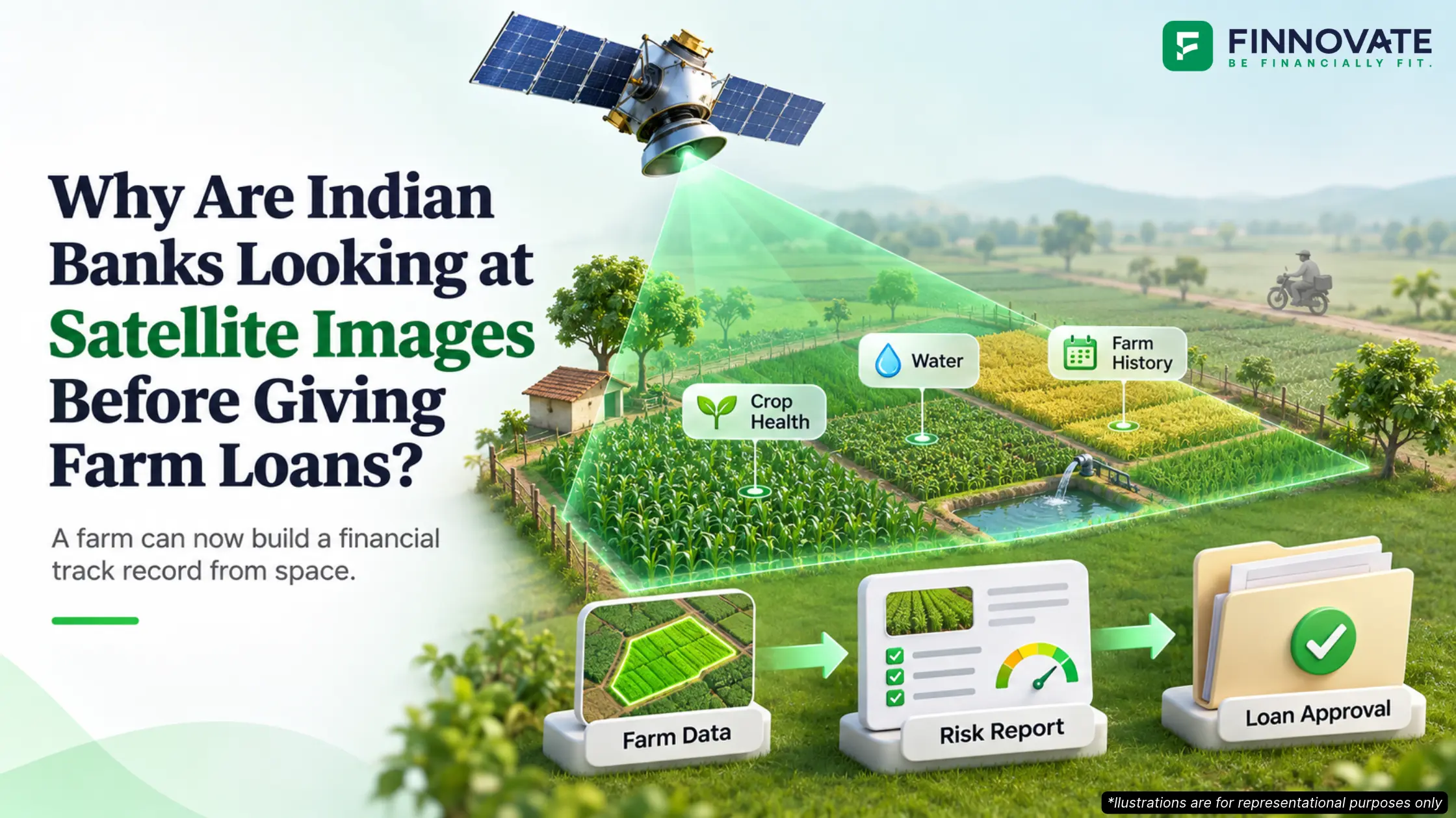
SatSure feeds these images into AI models, along with weather data such as rainfall, temperature and groundwater levels. By tracking one plot across several kharif and rabi seasons, it builds what is essentially a track record for the land itself:
- Is it being farmed? Whether the plot is cultivated or lying empty.
- What crop? Different crops look different from above and grow on different calendars, so the software can tell paddy from cotton or sugarcane.
- How healthy? Signs of crop stress, often early in the season.
- Past performance. Archived images show how the farm did in previous seasons.
- Water. Whether irrigation is nearby, or the farm depends entirely on rain.
All of this rolls up into a farm-level risk score. SatSure calls its version a SatSource report, and says it has analysed more than 2.1 million farm plots.
The report isn't a yes or a no. The bank still makes the call. But it now decides with a picture of the farm instead of a guess.
These reports reach banks through public infrastructure. SatSure's product is part of the RBI's Unified Lending Interface (ULI), a network that does for loan data roughly what UPI did for payments. With the borrower's consent, lenders on ULI can pull land records, e-KYC details and satellite data in one place. As of December 2025, 64 lenders were on it. SatSure says public sector banks, including State Bank of India, use its reports to process farm loans in minutes rather than weeks.
Why Banks Are Becoming Shareholders
It's one thing for a bank to buy software from a startup. Buying a stake in it is quite another.
Yet that's what ICICI Bank, Kotak Mahindra Bank and HDFC Ltd (since merged into HDFC Bank) did in February 2022, when they came in as strategic investors. The reasoning has three parts.
First, cost. Checking a farm from orbit is far cheaper than sending people. ICICI Bank has described using satellite data to assess farmers' credit quickly without anyone visiting in person. For small loans, that changes the economics.
Second, early warning. SatSure also gives banks a climate risk tool that flags crop stress across a loan book. If a bank can see drought building across a district before the harvest, it has time to prepare. It could, for example, discuss repayment schedules early instead of chasing overdue loans later. How well each bank uses this is up to that bank.
Third, the lending targets. Banks have to lend to farmers anyway. Better data lets them grow that lending in remote areas with a clearer view of the risk they are taking on.
When a tool sits this close to a bank's core business, owning a piece of it buys a say in how it develops, plus a share of the gains as other lenders sign up. And they have: SatSure says it now has 24 banking and financial services customers.
The Bigger Space Race
The ₹60 crore from AVCF suggests this is no longer just a banking experiment.
AVCF is anchored by IN-SPACe, the government body that promotes and authorises private space activity. It is managed by SIDBI Venture Capital and has a target size of ₹1,600 crore. Its first investment, in July 2026, went to Dhruva Space, which builds satellite hardware. SatSure is its first bet on the data side of space: the layer that turns pictures into something a business will pay for.
That makes sense. A satellite is an expensive camera. The money is made by whoever can read the pictures.
SatSure wants to own both ends. Today, like most analytics companies, it works with images from satellites run by others. Through its subsidiary KaleidEO, it is building its own optical payloads, targeted for orbit in 2027. It is also part of a Pixxel-led group building India's 12-satellite national Earth-observation constellation, and SatSure is building two of those satellites. Alongside this, it is developing Dhaarini, an AI model trained to read Earth imagery.
The new money goes into all of these, and into growing the business outside India.
Where It Still Falls Short
None of this is magic, and the gaps matter.
Clouds. India's main farming season, kharif, runs through the monsoon. Optical satellites can't see through clouds. Radar satellites can, which is why the national constellation uses both types.
The satellite sees the crop, not the owner. Linking a plot to a name still depends on digitised land records, and their quality varies widely from state to state. A tenant farmer may be growing the crop while someone else's name is on the papers.
Accuracy is still debated. Experts have questioned whether yield estimates from technology can fully replace measuring crops by hand, and whether farmers will trust a number that comes from space.
Adoption is uneven. Bankers have said large lenders were slow to move onto ULI, partly because land records lag behind.
Hardware takes time. In 2021, SatSure was reported to be planning four of its own satellites by 2024. That timeline has moved to 2027.
What This Means for You
Even if you never apply for a crop loan, this matters in three ways.
Rural demand. When farm credit arrives on time, inside the sowing window, it goes into seeds, fertiliser and labour. From there it flows into rural spending on tractors, two-wheelers and everyday goods. (Read our article on: Rabi Sowing 2026: Impact on Food Prices and Rural Demand)
Lending beyond the credit score. Satellite data is one of many kinds of alternative data now moving through ULI, along with land records, GST filings and dairy records. The same shift is helping self-employed and first-time borrowers who don't fit the salary-slip model. Satellites are also already used to confirm that a mortgaged property exists, or that a construction project is on schedule.
Farmland you may own. Many professionals hold ancestral farmland they rarely visit. As land records connect to lending networks, an accurate, up-to-date record matters more than it used to.
The Bottom Line
For decades, satellites in India meant launches, missions and national pride. Now they are quietly turning up somewhere far more ordinary: a loan file.
A farmer in a remote village may still be miles from the nearest ATM. But to his bank, his farm is now in plain sight.
FAQs
1. Why do Indian banks use satellite images for farm loans?
Satellite images let banks check whether land is being farmed, what crop is growing, how healthy it is and how the plot did in past seasons, without a field visit. This makes small farm loans faster and cheaper to process.
2. What is the Unified Lending Interface (ULI)?
ULI is a digital lending platform built by the RBI's innovation hub and announced in August 2024. With the borrower's consent, it lets lenders access data such as land records, e-KYC and satellite data. As of December 2025, 64 lenders were on it.
3. Can satellites see crops during the monsoon?
Optical satellites can't see through cloud cover. Radar satellites can, which is why India's planned national constellation combines both types.
4. Does satellite data decide whether a farmer gets a loan?
No. Providers like SatSure give the lender a report and risk score for the farm, and the bank still makes the decision.
5. Why do HDFC Bank and ICICI Bank own a stake in SatSure?
Both came in as strategic investors in 2022, along with Kotak Mahindra Bank, and both also use SatSure's products. Owning a stake gives the banks a say in a tool they depend on for farm lending.
Sources
- Business Standard: Antariksh Venture Capital Fund invests ₹60 crore in SatSure's Series B
- RBI: Master Directions on Priority Sector Lending, Targets and Classification
- RBI Innovation Hub: Unified Lending Interface
- RBI Innovation Hub: End-to-end digitalisation of KCC lending
- Business Standard: Lenders onboarded on ULI rise to 64
- Business Standard: Slow adoption and weak land records stall ULI scale-up
- SatSure: ICICI Bank, Kotak Mahindra Bank and HDFC Ltd join as investors
Disclaimer: This article is for information and awareness only. It is not a recommendation to buy, sell or hold any security, fund or investment product. Companies and institutions are named only for context.